MAP MAKER 5 ![]()
Altitude data
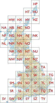
The altitude data is in the form of tiles, 10km x 10km, with spot heights on a 50m grid. The data is stored in the Map Maker "ter" format. This data is derived the Ordnance Survey "Terrain 50" data.
Click on a region to access the tiles.
..or alternatively, download all of the terrain data for the UK here
Other national datasets
Download water courses and coastline for Great Britain (DRA format), based on Ordnance Survey "ZoomStack" data here.
Download the Forestry Commision's National Forest Inventory (2018) for Great Britain (SHP format) here.
Download the Forestry Commision's National Forest Tracks (2018) for Great Britain (SHP format) here.
This page last updated: Sat Mar 15 2025